
 |
 |
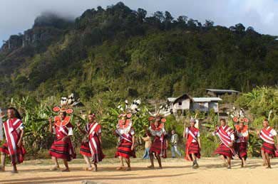 |
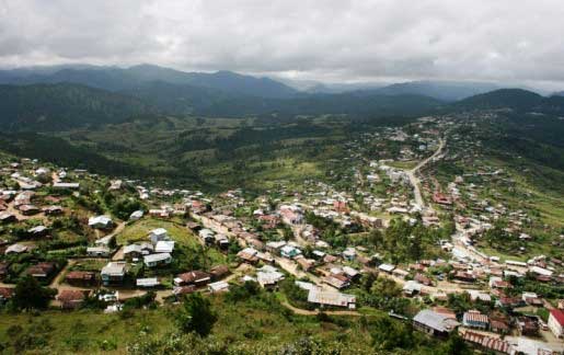
Chin State is a land of tattoo-faced hill tribes and exotic travel destination in western Myanmar between 20o 40 'N and 24o 06'N latitudes and 92o 37'E and 94o 09'E longitudes. It has 36,019-square-kilometre (13,907 sq mi) and is bordered by Sagaing Division and Magway Division to the east, Rakkhine State to the south, Bangladesh to the south-west, and the Indian states of Mizoram to the west. As of national census in 2014, the population of Chin state is about 478,801. The capital of the state is Hakha which was a main village and it is the highest sea-level town in the country. The state is a very mountainous region with difficult transportation system. Chin State is sparsely populated mainly on the hills, valleys and cliffs. Most of the Chin people are devoting in Christianity.
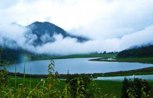
Chin state is very colorful with different and diverse cultures, foods, languages and living styles and spectacular destinations such as Natmataung National Wildlife Sanctuary, heart-shaped lake 'Reid', Mt. Bonetalar and Bonetalar waterfall, trekking sites and hiking mountains.Nat Ma Taung (or) Mount Victoria, national park is located in Kanpet-let, Mindut and Matupi townships of southern Chin State. It covers an area of 279 square miles, and is established in 1994.